
- Elevation 1592m
- When to climb April to November
- The Aso crater is directly accessible without any hiking. To hike up to the highest peak of Mt Taka-dake, expect to hike a roundtrip course of 9km over 5 hours
Mountain stats
Accessible via a shuttle bus from Aso station. The first bus doesn't depart until 9:55, so if you are coming in a large group, a taxi may be a viable alternative.
Coming by car is also an option, especially if you would like to start your hike early. The carparks generally cost 1000 yen, and the ones closest to the crater also have an extra 1000 yen toll.
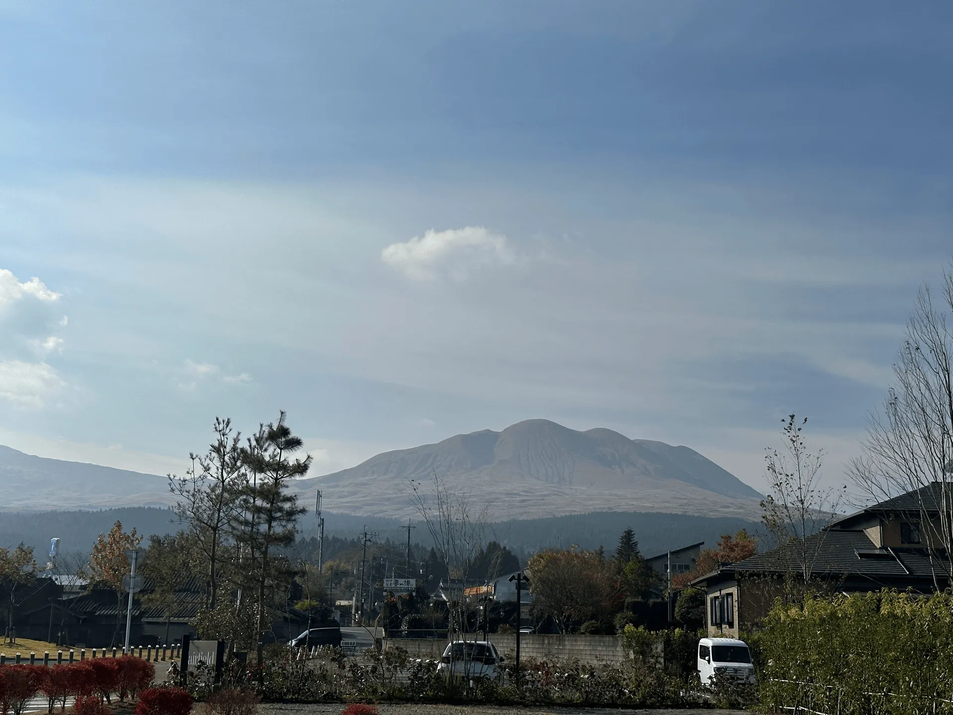
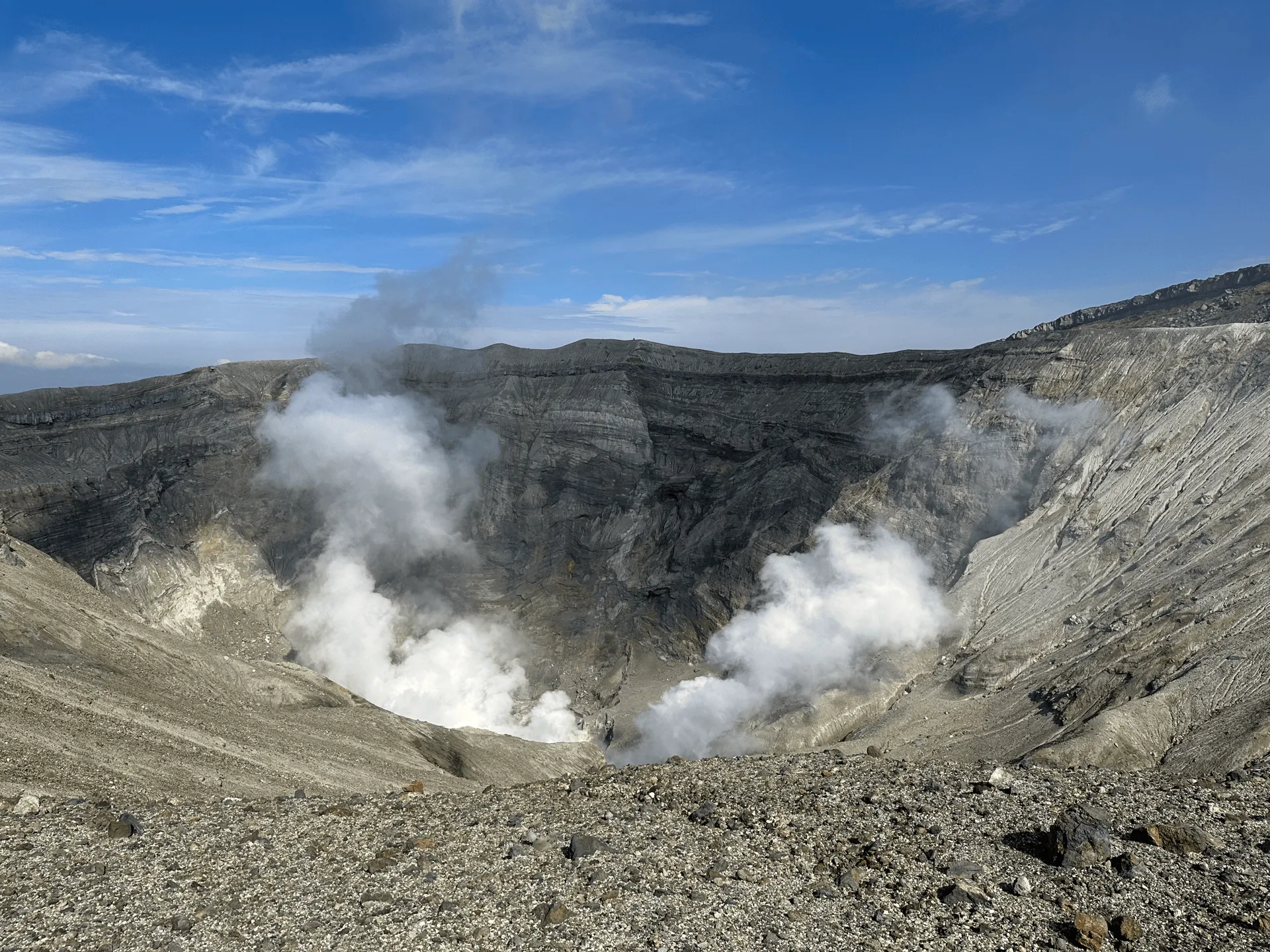
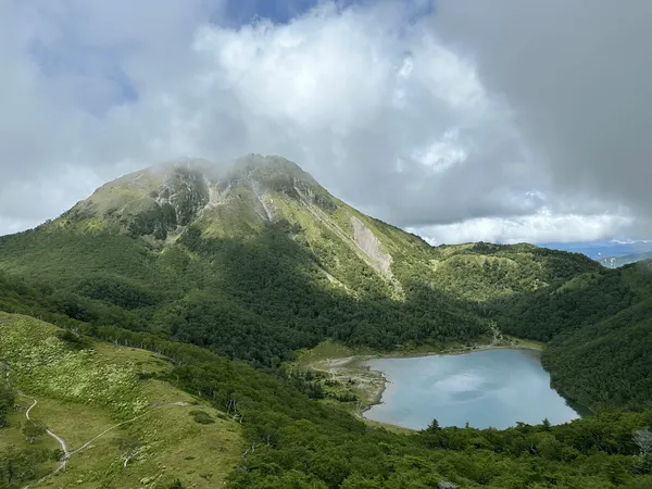
Mt Aso (阿蘇山, aso-san) is the largest active volcano in Japan. It’s most iconic feature is the Nakadake crater, which billows out clouds of white smoke. From the crater, you can hike through a Mars-like landscape up to Mt Aso’s highest peak, Mt Take-dake, which has an elevation of 1591m. The hike also gives you a great opportunity to view the crater from above!
As Mt Aso is such an active volcano, depending on its activity level it can be closed off to visitors. As of writing this post it is open, but it was closed as recently as July of 2024 so I recommend double-checking before you go.
I climbed Mt Aso part of my 2023 Kyushu hiking trip. After climbing the nearby Mt Kuju the day before, I had a good night’s rest at nearby hotel before beginning my day at Aso station, which has a shuttle bus up to the mountain.
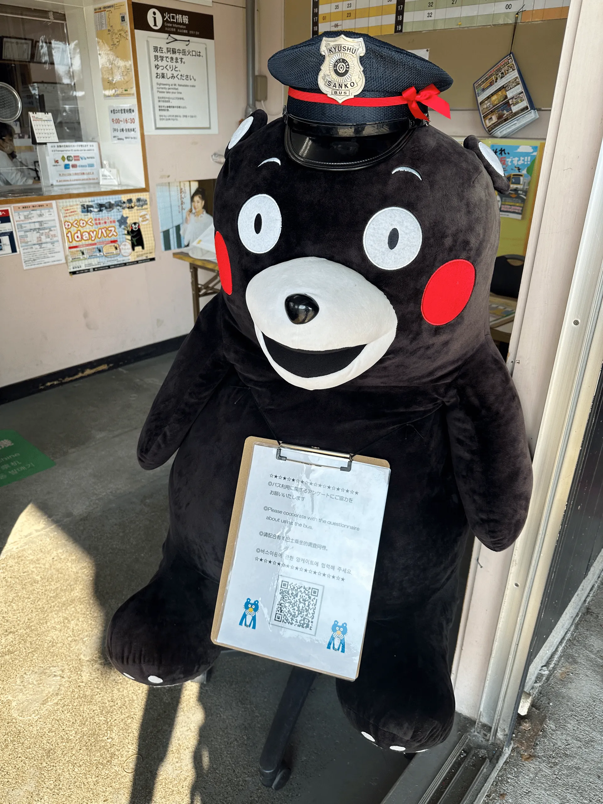
Being in Kumamoto prefecture, Kumamon was absolutely everywhere. (No complaints, I love him).
The bus will take you up most of the way, but the last 2km requires you to get onto a second shuttle bus to reach the Nakadake crater, where you begin your hike.
The drive up to Mt Aso is quite scenic, so even if you don’t want to climb to its peak, plenty of tourists come just to visit the crater and the nearby shops and museum.

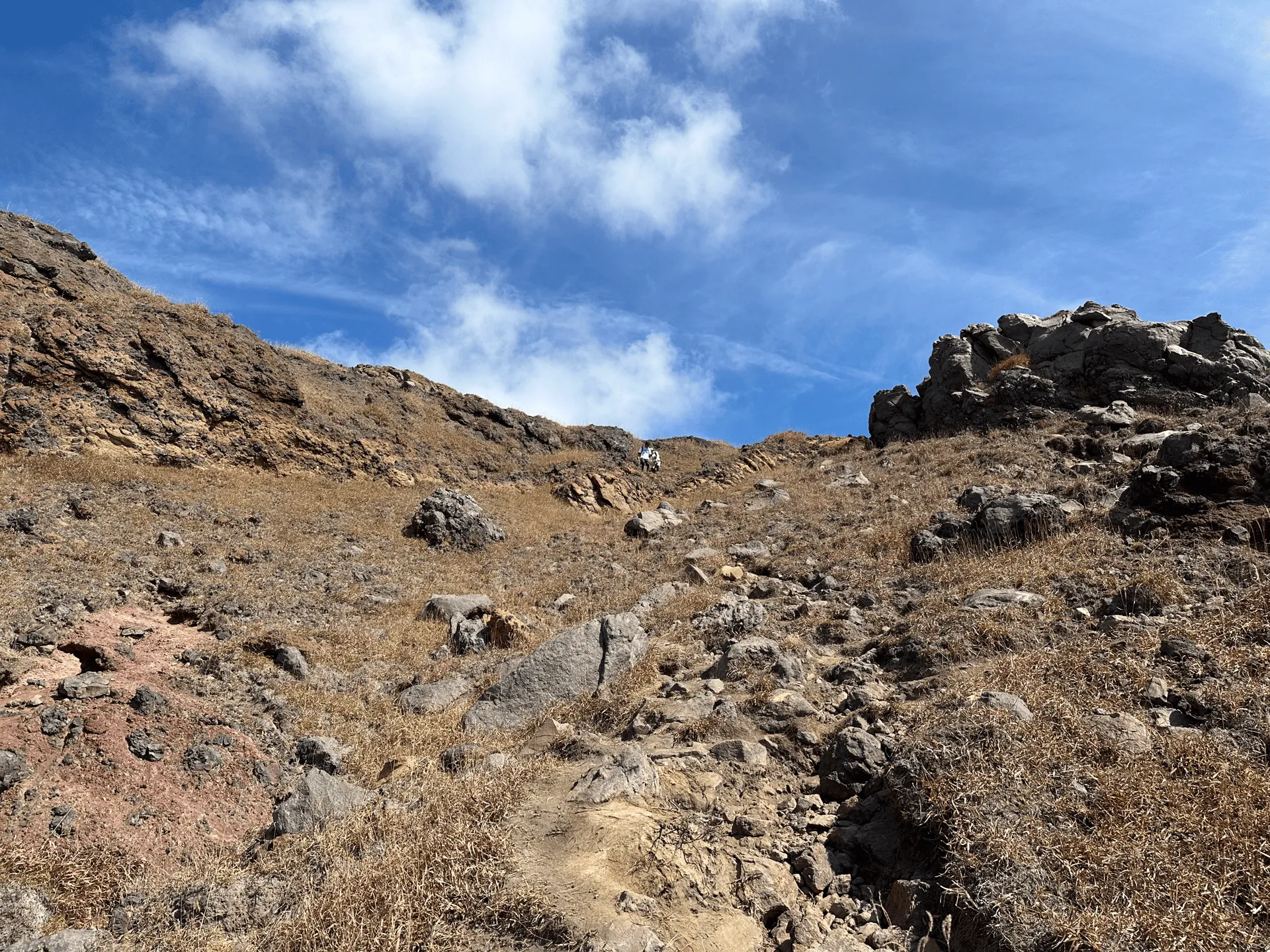
The hiking trail starts off with a long flat stretch across a boardwalk. With just sand, rocks and mountains around you, it feels like you are on Mars or somewhere completely remote.


As you leave the boardwalk, you can see the route stretch out in front of you.

Although the course was fairly short, this was my third day in a row of climbing after Mt Sobo and Mt Kuju and so I was feeling pretty tired as I made the climb up.
Once you make it up to the ridgeline, you can see out to the Nakadake crater below.
From here the trail continues to the actual peak of Mt Nakadake (中岳, naka-dake).


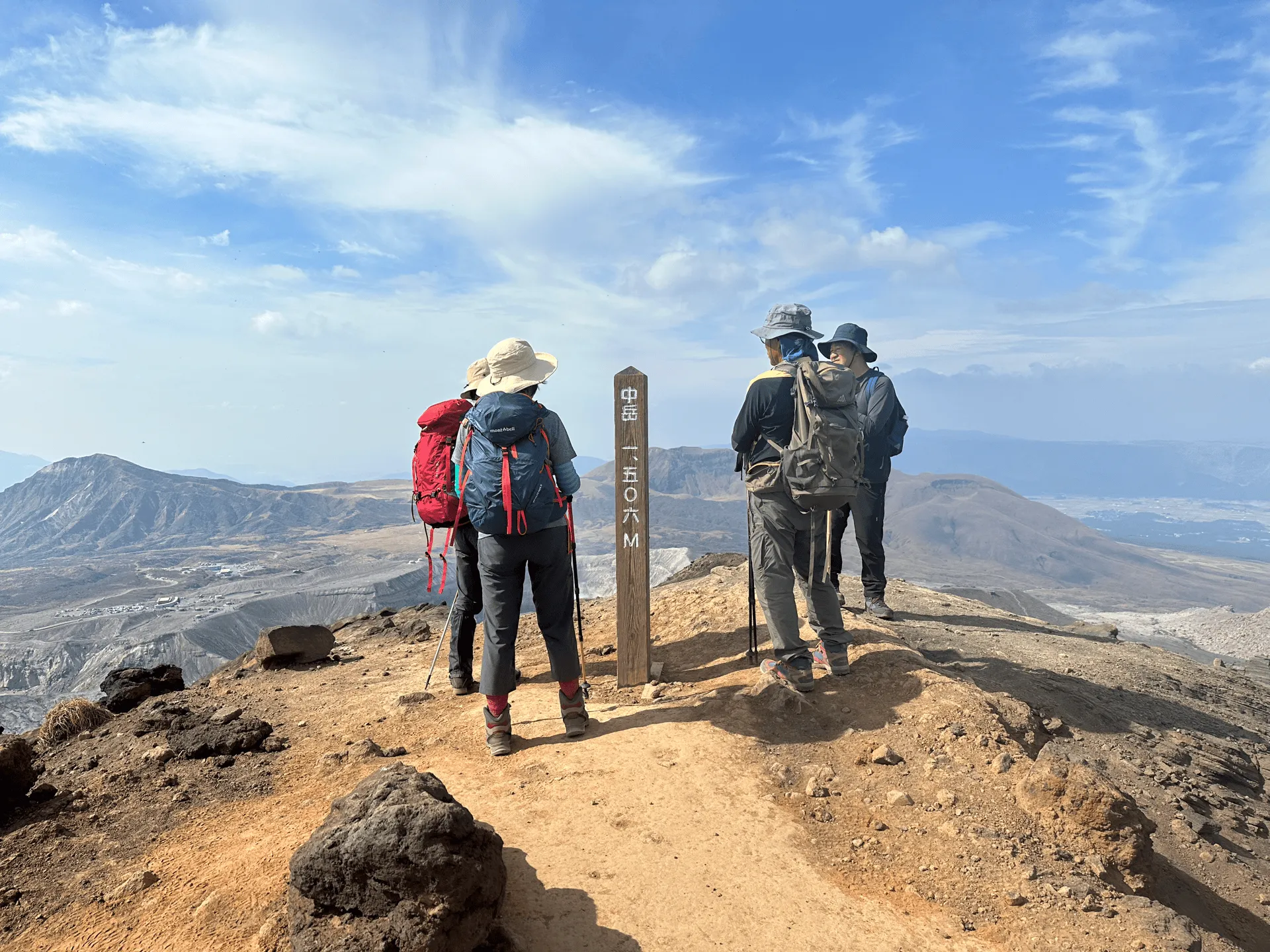
Once past Mt Nakadake, the trail continues along to Mt Takadake (高岳, taka-dake), the highest point on Mt Aso.


From here, you retrace your steps back to the trailhead.


I skipped waiting for the first shuttle bus on the way back, since it was only a downhill 2km walk to the second shuttle bus.

Back at the visitor centre, I was yet again graced by Kumamon’s presence, before I got a bus back to Aso station.

I stopped by the local onsen before getting on a train towards Kagoshima. I had one final mountain, Kaimondake, left in my Kyushu trip.


Hiking course details
| Date climbed | Length | Course time |
|---|---|---|
| 2023-11-04 | 9km | 5h40min (the expected time for an average hiker without breaks) |
The course is a 9km out-and-back course starting at the Furuboucho trailhead (古坊中登山口) near the smoking crater. Once you’ve explored the crater, you’ll head to the Sunasenri trailhead (砂千里登山口) where you begin your hike. I couldn’t quite find an identical course on Alltrails to what I see on YAMAP, but this one seems to be quite similar.
Toilets are only available at the visitor centre, so make sure to go before you begin your hike!
Public transportation access
Mt Aso is accessible via a shuttle bus from Aso station. The first shuttle bus leaves the station at 9:55, so to give you enough time to hike, this is the one you’ll want to aim for. Once you arrive at Aso station, there is a ticketing machine where you can buy shuttle bus tickets.
Coming by train
You can access Aso station via the JR Line. If you are coming from Kumamoto, expect it to take 80 - 90 minutes by train (you may need to transfer once) on the JR line. When I hiked, I found that a lot of people arrived at Aso station at 9:45 in time for the shuttle bus. However, there were so many people that had the same idea, that a couple of people actually couldn’t make it onto the bus, and had to wait an hour for the next shuttle bus instead.
I would recommend either speedily getting off the train, or even getting an earlier one if that is an option, if you want to be sure to get a spot on the shuttle bus.
Coming by limousine bus
Since I spent the night before at Higo-Ozu station (肥後大津駅), I actually opted for a limousine bus instead. This got me to the station at 9:30, which gave me plenty of time to take some photos around the station and then line up for the shuttle bus.
If you are coming from Kumamoto station, this is also an option. You can first get the train to Higo-ozu station, and then the limousine bus to Aso station. It actually costs about the same, and takes about the same amount of time, so if you don’t mind making the transfer, I think this is a pretty good option if you want to be sure about getting on the shuttle.
With the limousine buses, since they are fixed seating I’m not sure if you can just hop on - you may need to buy the ticket in advance on Bushikaku.
Getting the shuttle bus back after your trip
The last buses back to Aso station are at 15:50 and 16:30 so as long as you are mindful to finish your hike in time for those, you should be good!
Car access
The Mt Aso crater is also accessible by car, and a good option if you want to start on your hike early, as the shuttle bus comes relatively late in the day.
To park your car, there are a number of carparks available (the website linked is in Japanese, but you should be able to use Google translate).
The two closest to the Aso crater (阿蘇山頂駐車場 and 砂千里ヶ浜駐車場) are both paid carparks, and cost 1000 yen. Furthermore, to reach this carpark you will need to pay a 1000 fee at a toll gate.
The third one on the list (阿蘇山上無料駐車場) is the only free option, but is right next to a paid one, so you have to be sure not to get them mixed up.
When to hike Mt Aso
Snowfall is always a little variable, but Mt Aso generally has snow from late December to early March, so it’s safe to climb outside of these periods. I always recommend checking the latest trail conditions on YAMAP before you hike. For example, there was actually a period of snow at the end of November 2024 before it seemed to clear up again.
One particular highlight of Mt Aso is in late May, when the pink Kyushu azalea bloom. As a result, this is by far the most popular time of year for hikers to visit Mt Aso - you can see on YAMAP that over 20% of hikes are in May alone.
Comments
Leave a comment