- Elevation 1491m
- When to climb April - May, October - January
- There are two trailheads (Okura and Yabitsu-toge). Hiking from either one will take at least 13km over 8 hours. Can be done as a day trip from Tokyo.
Mountain stats
2 hours from Tokyo. Take the Odakyu line to Shibusawa station or Hadano station, then a local bus to the trailhead.
There are car parks at the trailheads, but with Mt Tonodake's popularity, I recommend taking public transport so you don't have to deal with finding a spot.
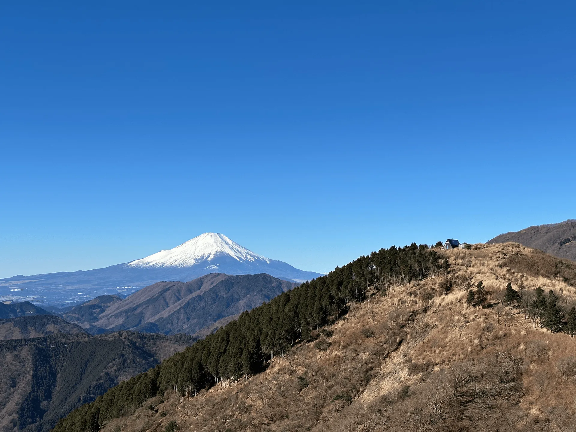
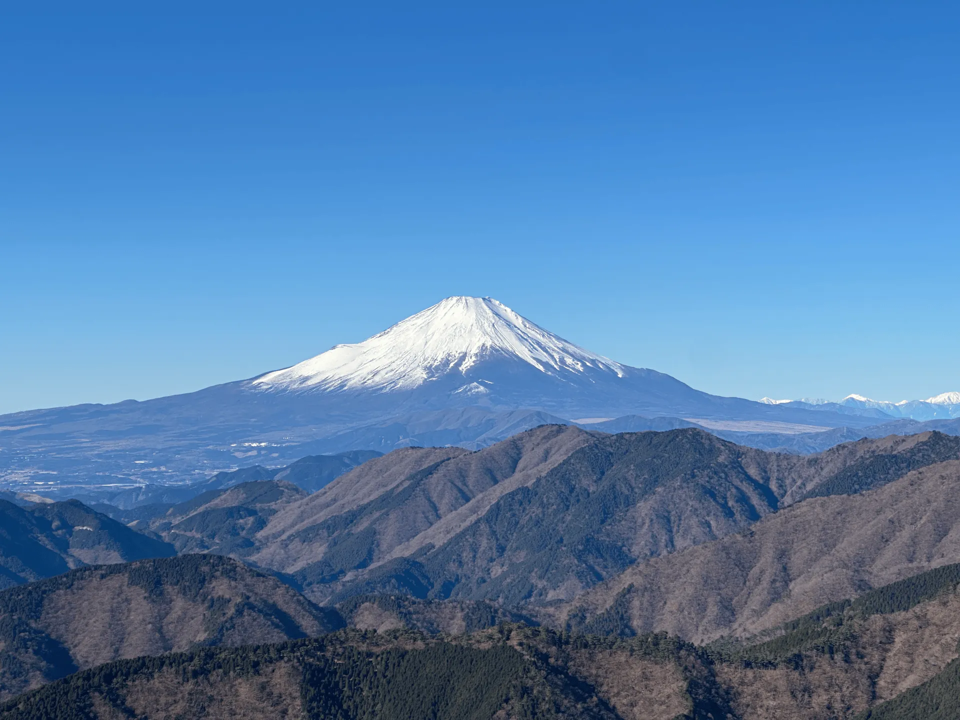
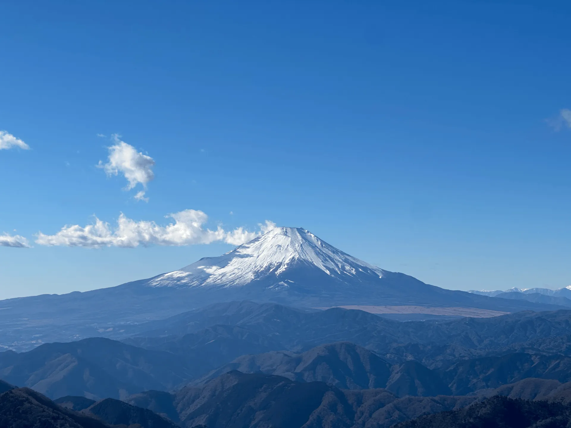
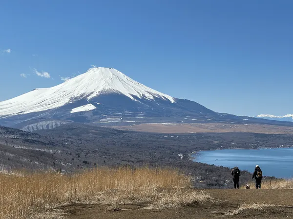
Mt Tonodake (塔ノ岳, tono-dake) is one of the most popular peaks in the Tanzawa mountain range. Its location in Kanagawa prefecture also makes it a great mountain to grab a view of Mt Fuji if the weather conditions are good.
I’ve climbed Mt Tonodake a number of times, but always via the Okura (大倉) trailhead. It’s well-known as a gruelling 3-hour climb of mostly stairs. For my first hike of 2025, I decided to hike it instead from Yabitsu Pass (ヤビツ峠, yabitsu-toge), which I’ve often heard is the more interesting trail. And it did not disappoint!
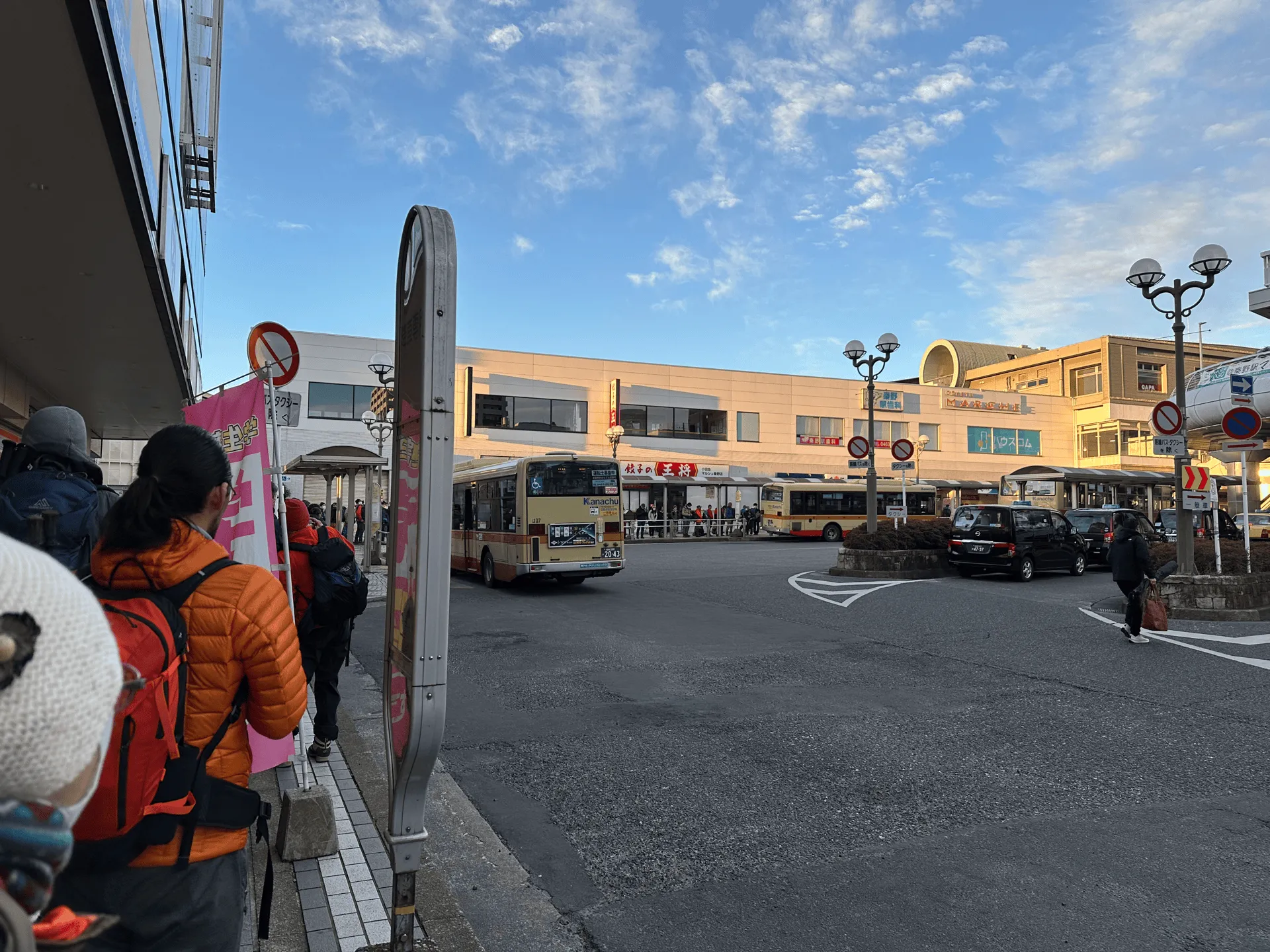
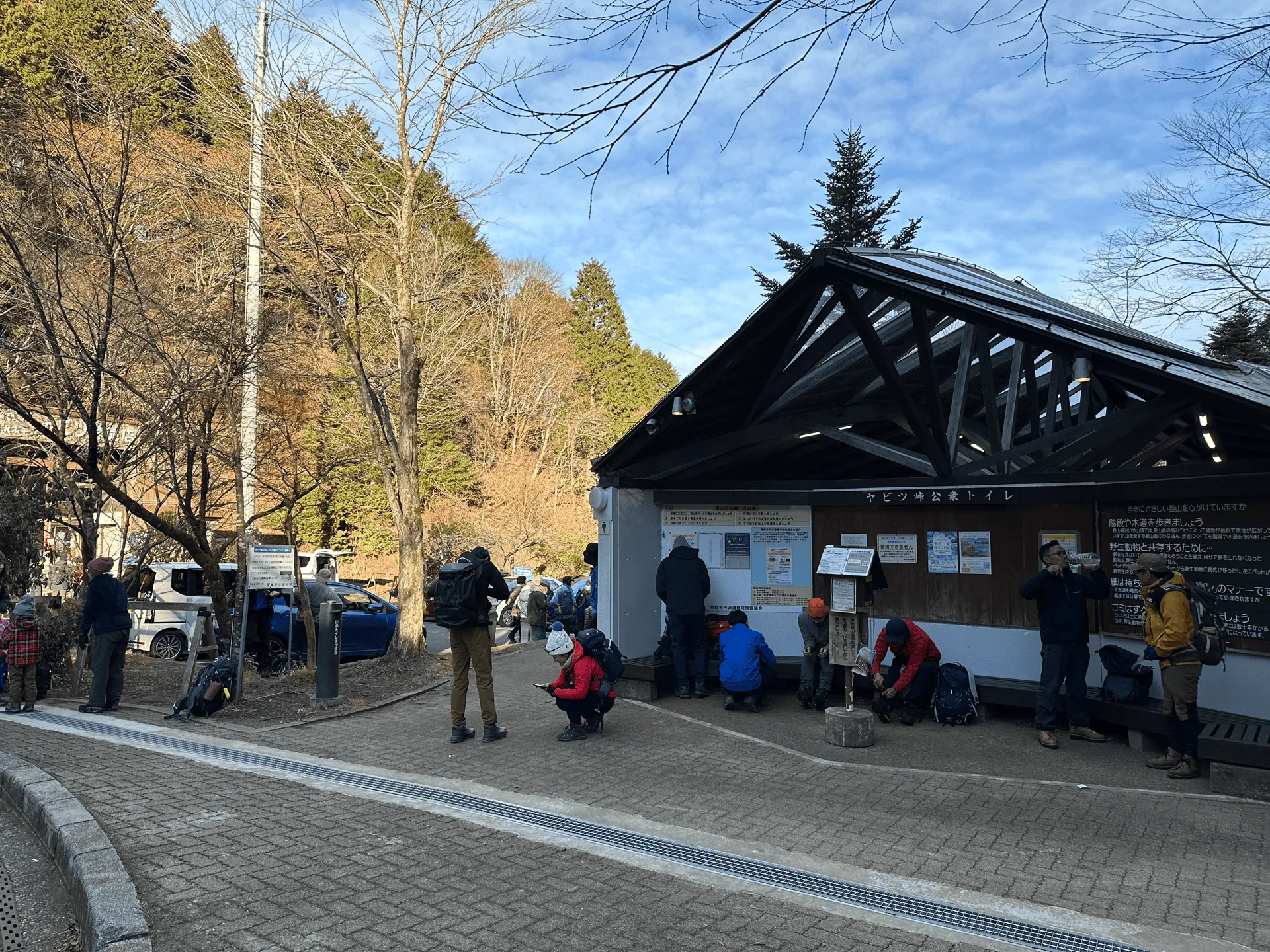
After getting on a very crowded bus, and enduring the ride up the long windy mountain road to the trailhead, we started our hike just after 8am. For a cold January morning, I wasn’t expecting there to be so many hikers but it was quite busy.
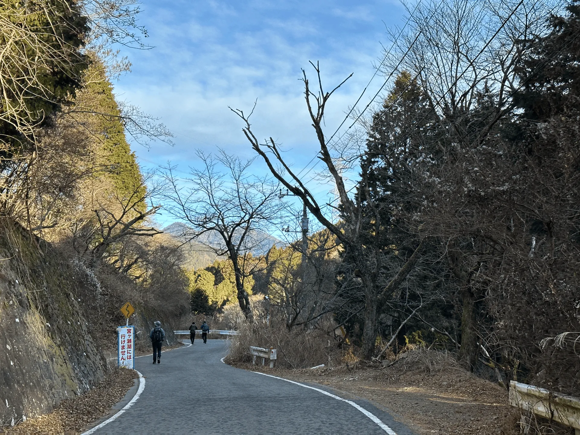
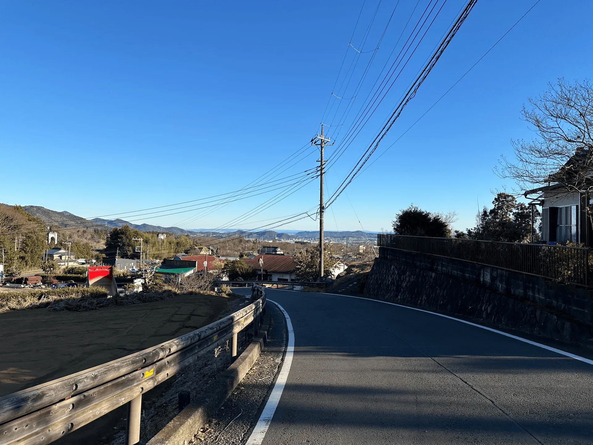
The first 20 minutes of the trail takes you down a regular road before you reach the real trailhead. We did have one taxi with hikers in it pass us by. Probably expensive, but a nice way to cut some distance off your hike.
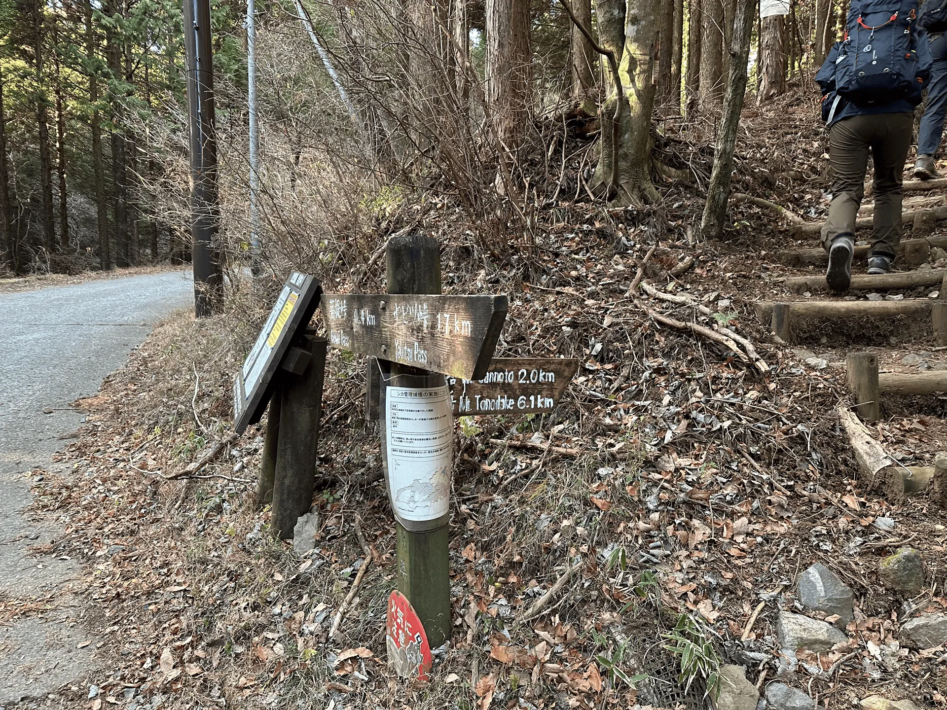
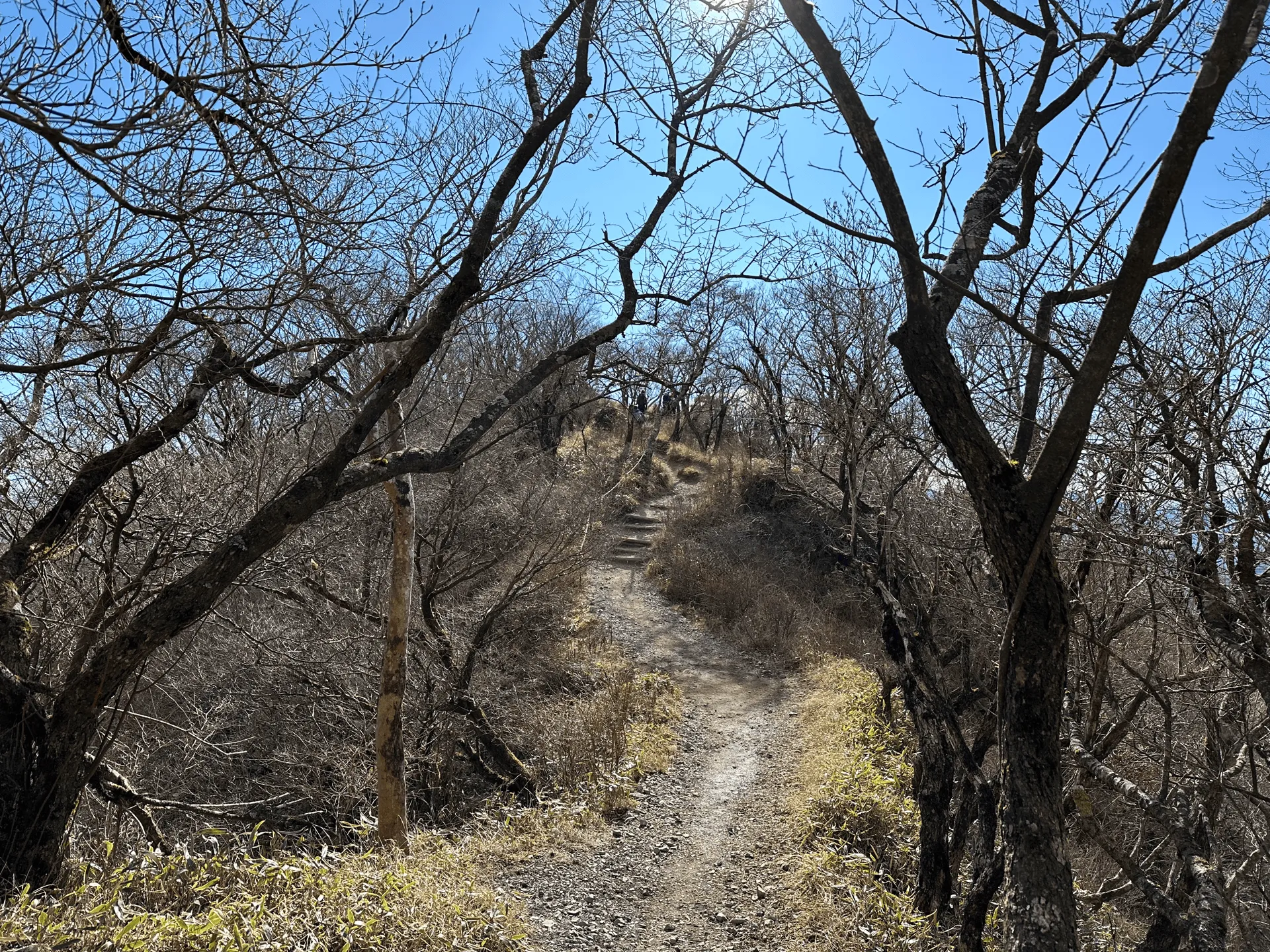
Having heard such good things about Yabitsu-toge, I was a little bit disappointed at first. “This feels just like Okura! Why are there so many stairs!”

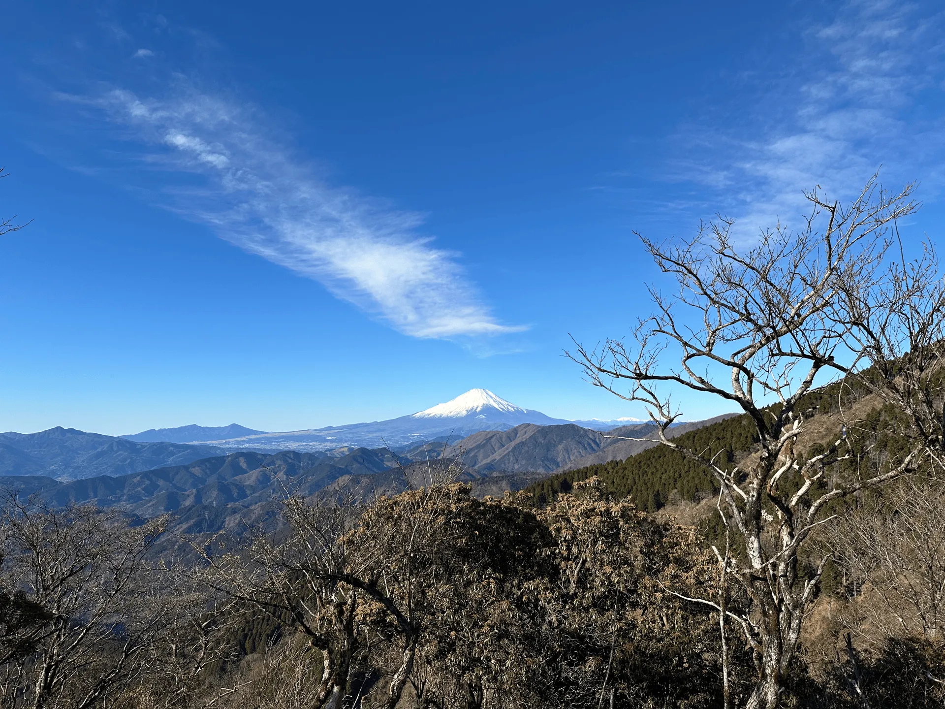
But by 9:30 we reached our first peak of Mt Ninoto (二ノ塔) and got our first glimpse of Mt Fuji - some great views.
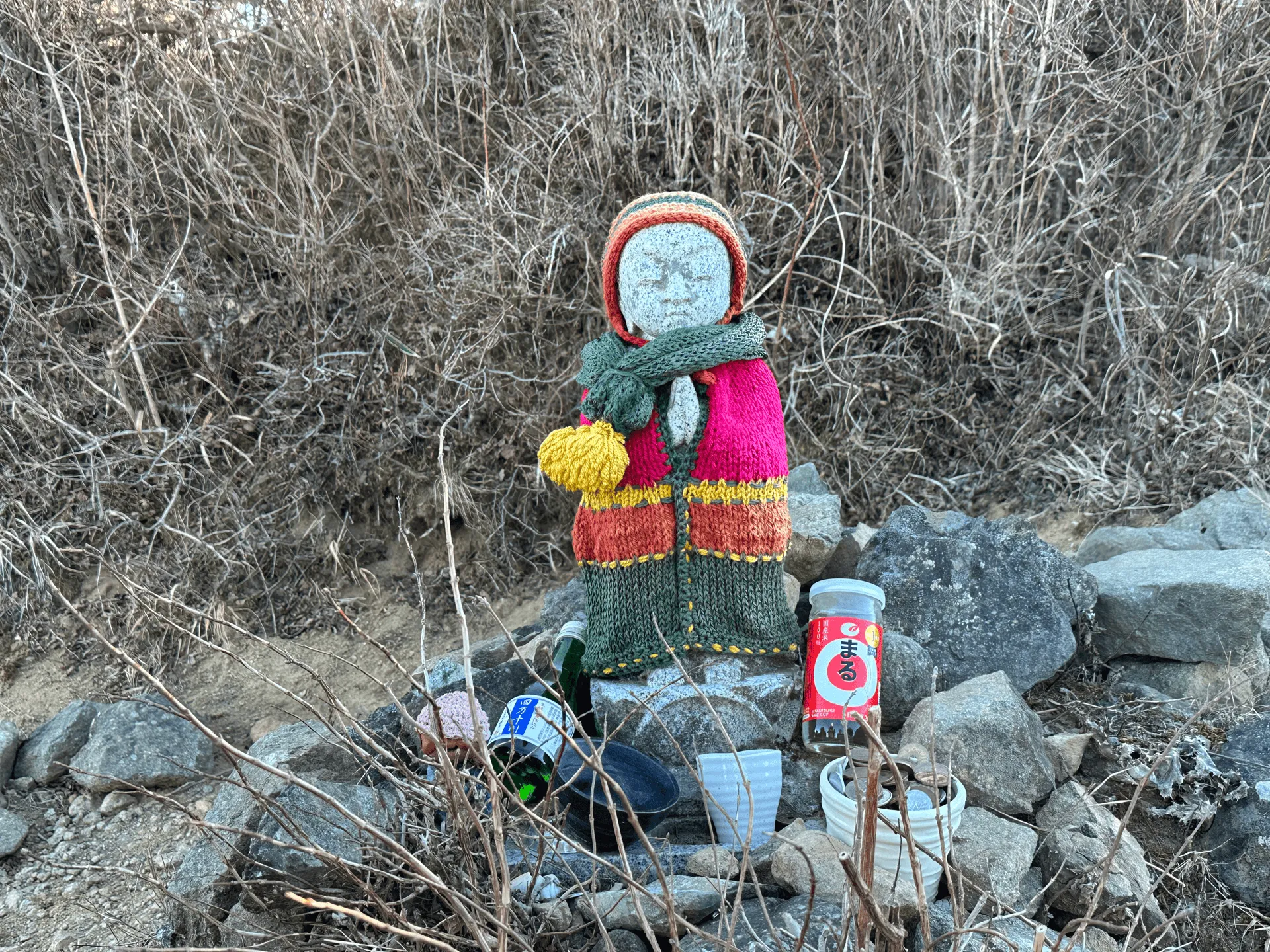
From here, it was back to more climbing, and more stairs. After a short while, you’ll pass the next peak of Mt Sannoto (三ノ塔). Mt Sannoto’s “san” (三) means three, and Mt Ninoto’s “ni” (二) means two - which makes you wonder, where is the first peak, Mt Ichinoto? Apparently it’s at a place called Karako shrine. The story goes, a long time ago some villagers saw three “sacred lights” in the night sky. At the first place, they built the shrine, and then the second and third places they named “ni” and “san”-noto.

It seems like Shugendo practitioners were also initially the ones using the mountain trails in the Tanzawa area. Nara’s Mt Omine and Shikoku’s Mt Ishizuchi are quite famous for being religious training grounds, but I didn’t realise their influence came up this far north. I’d never really thought about who hiked all of Japan’s mountains first. I’d be curious to know what percentage were due to religious reasons.
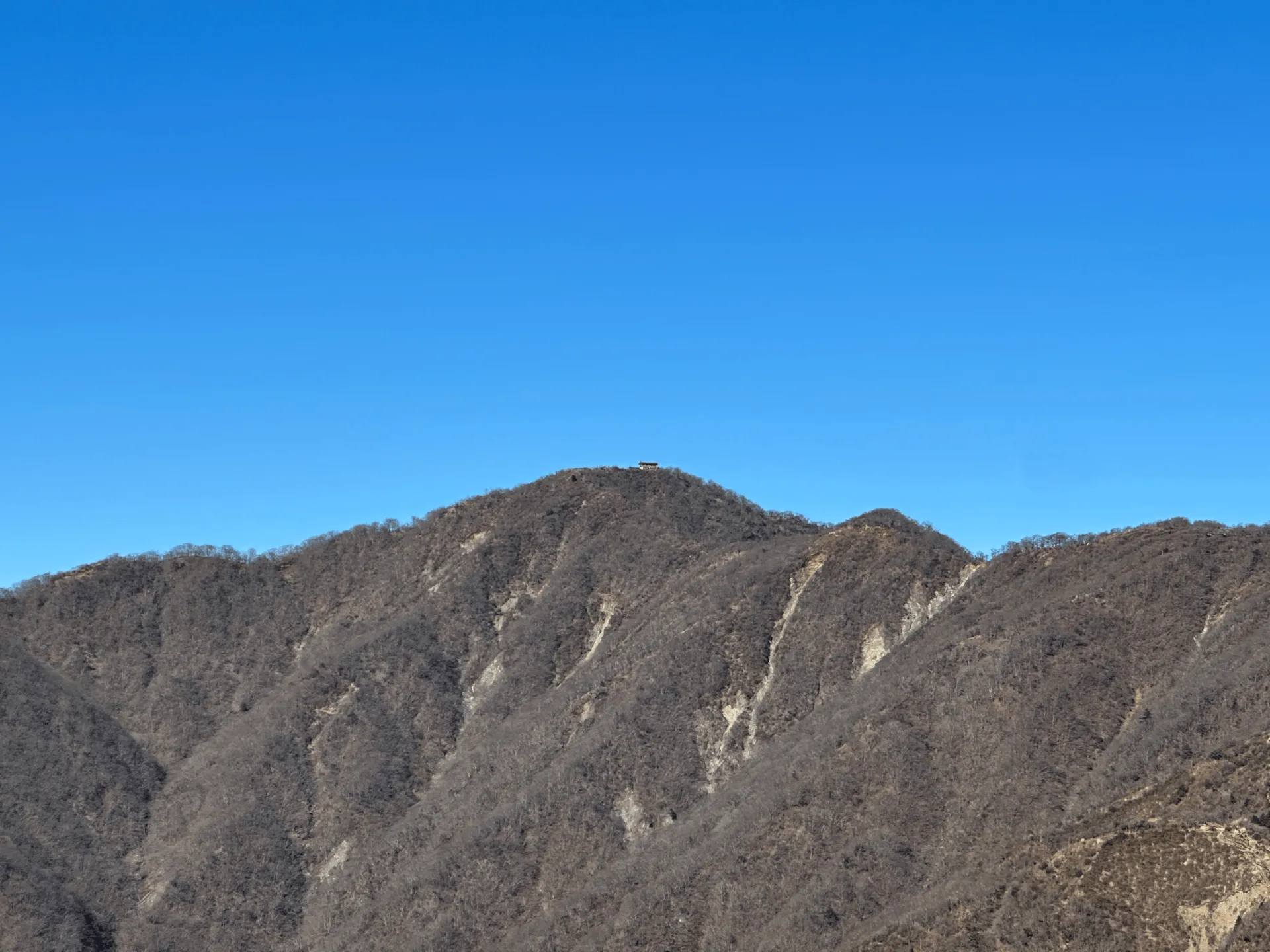
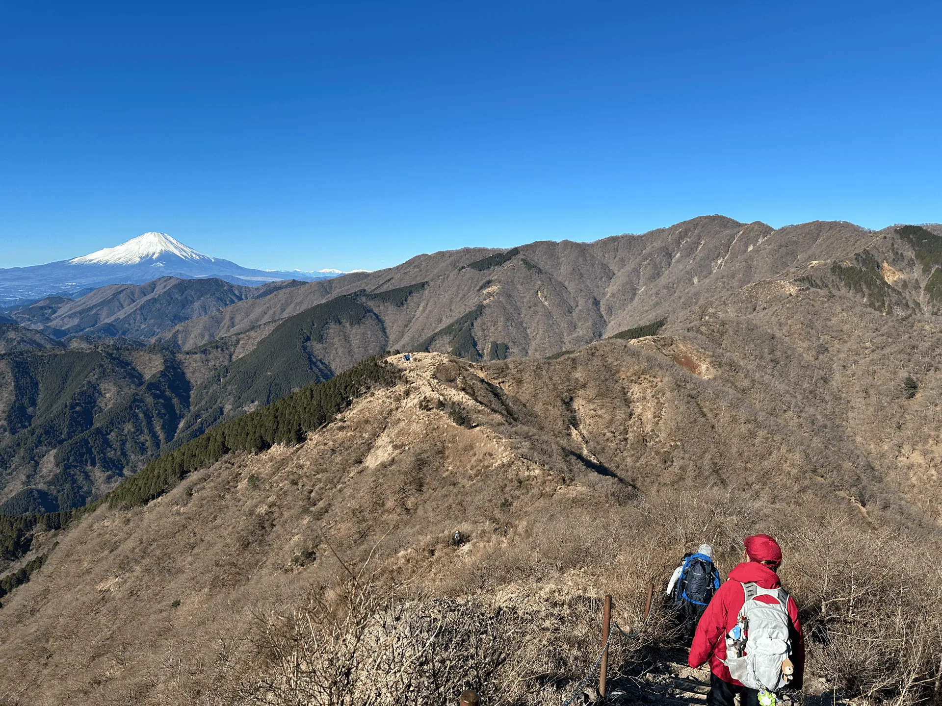
But anyway, back to the hike. From Mt Sannoto you get an even better view of Mt Fuji, and in the distance you can even see the tiny dot that is the mountain hut at Mt Tonodake’s peak.
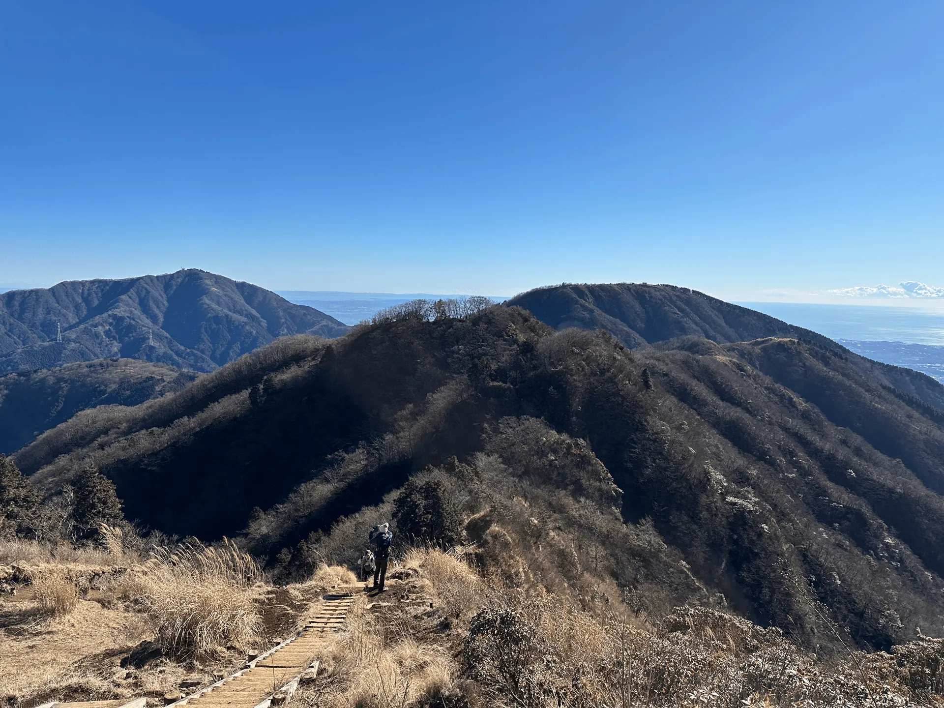
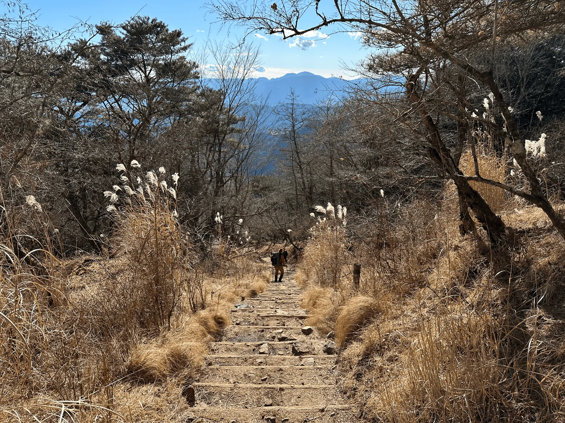
After reaching Mt Sannoto, I can really start to see the Yabitsu-toge trail’s appeal. You get this long exposed ridgeline walk, with views out to Mt Fuji in the distance. You do have some up-and-down portions, but the view more than makes up for it.
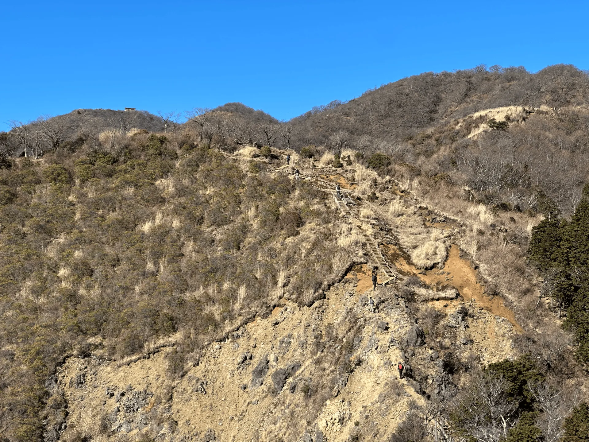
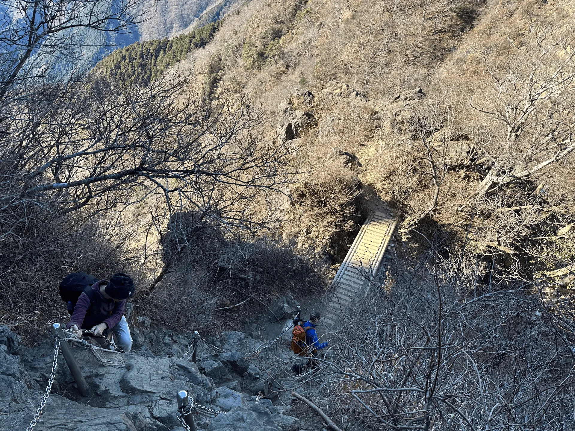
Unlike Okura, which is nearly all stairs, the Yabitsu-toge trail does have two small chain descent sections. As always, it’s hard to convey in a photo (it feels scarier in person) but overall I’d say this was on the milder side.

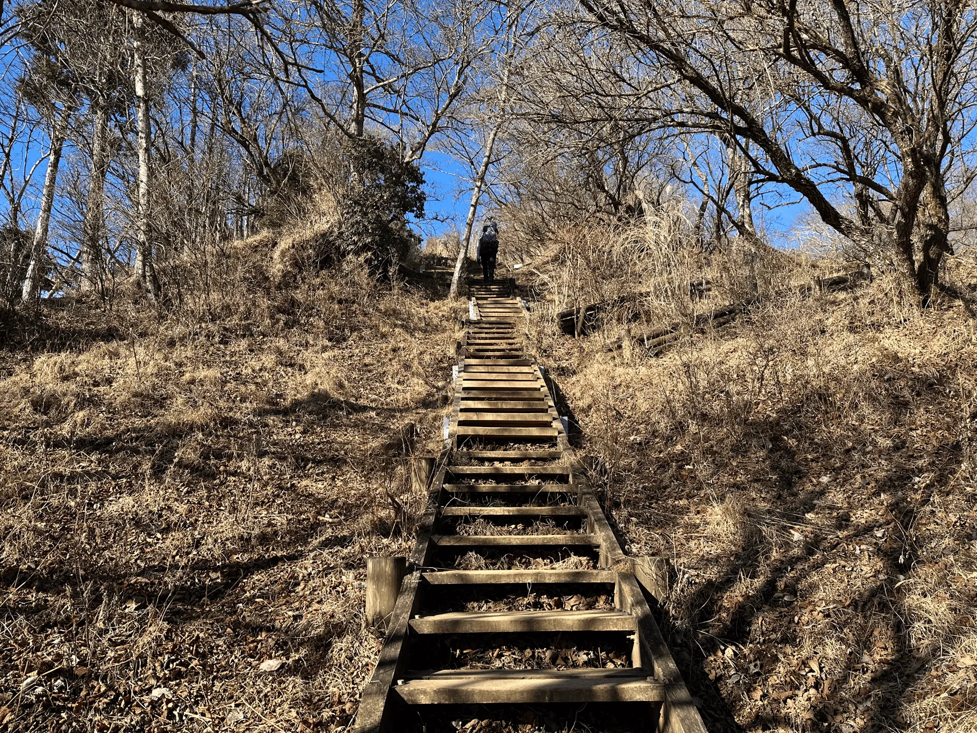
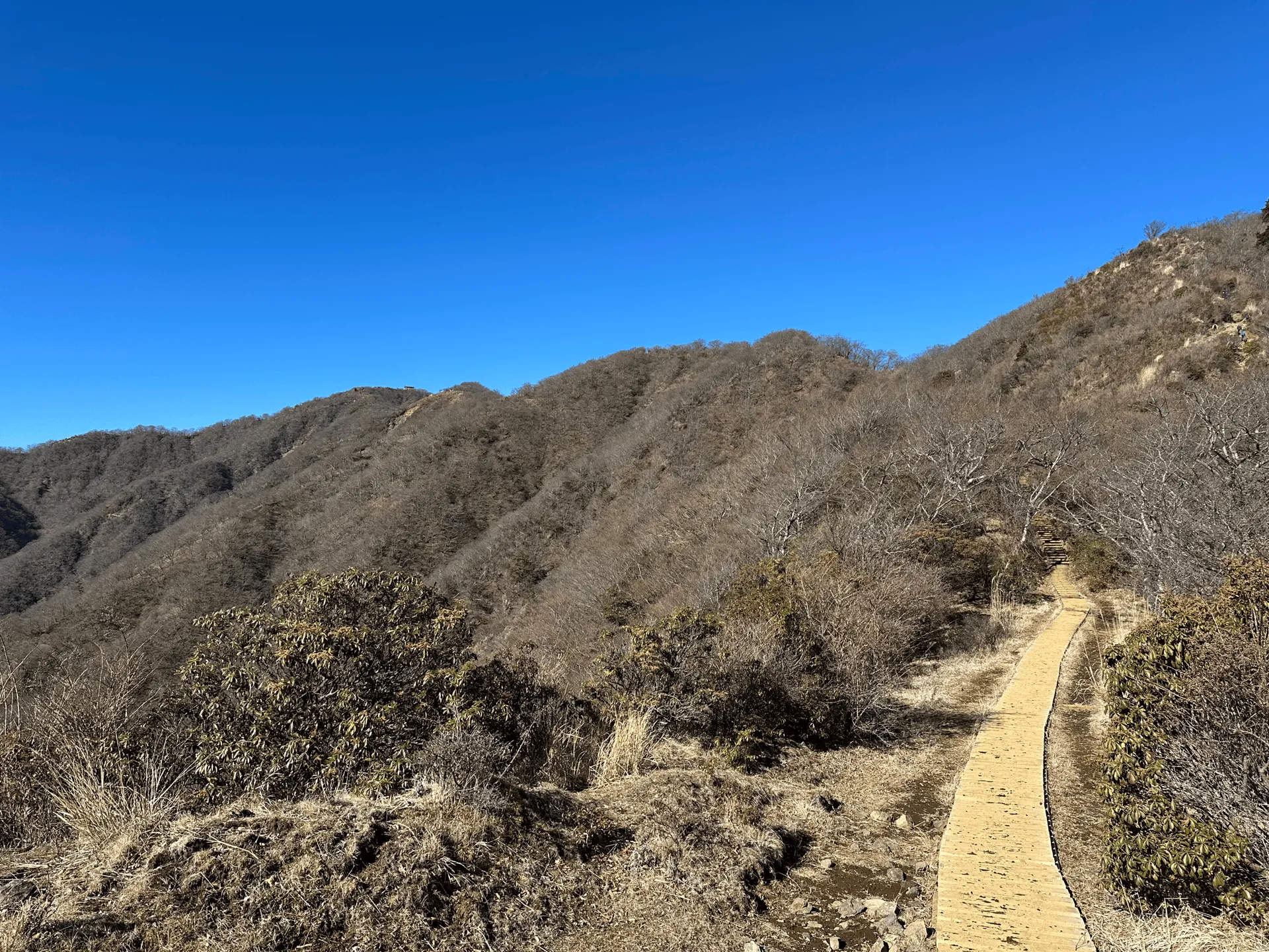
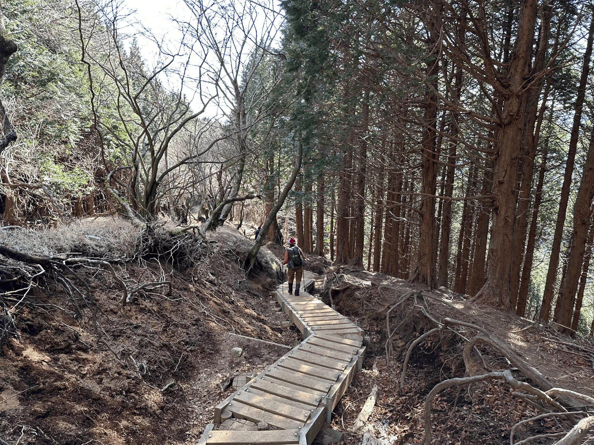
Another characteristic of the hiking trails in the Tanzawa area is that there are a lot of wooden stairs and boardwalks. So although the trail up to Mt Tonodake can be long, they really help make for a more comfortable hike.
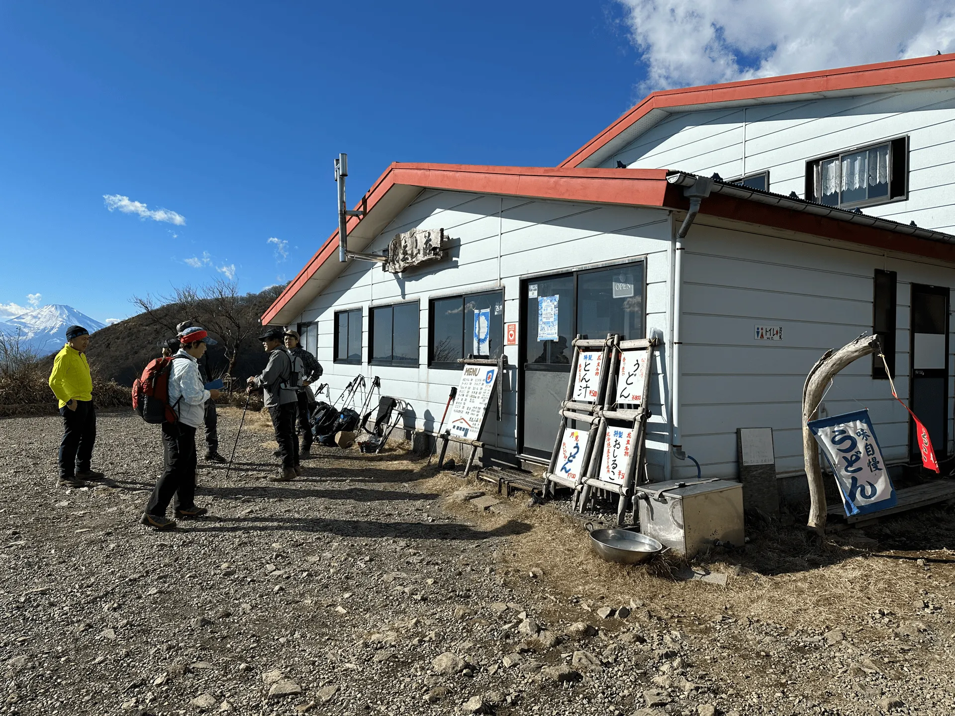
A little before 12:30, we reached the peak of Mt Tonodake (塔ノ岳). As far as peak markers go, it’s quite hefty one - probably close to 3m in height.
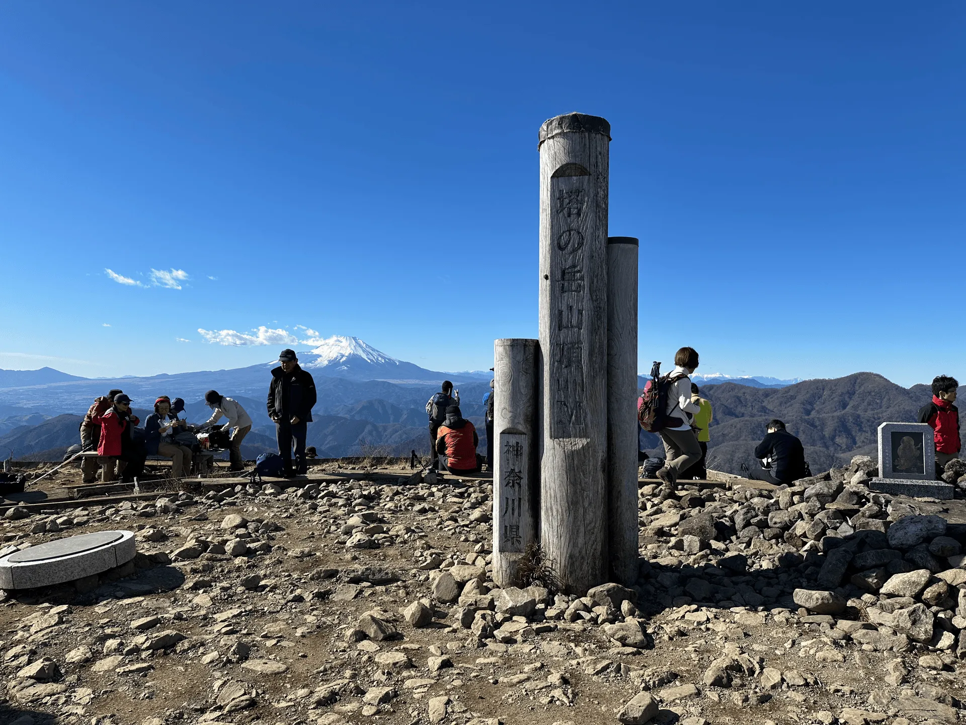
There are at least 4 different trails that converge on this summit (from Mt Nabewari, Mt Tanzawa, Okura and Yabitsu-toge) so it’s always a pretty busy interchange with lots of hikers. But it’s also a super wide area, so it doesn’t feel like the overwhelming crowds you sometimes get on other summits. There’s a mountain hut here too where you can warm up, if you don’t mind paying 500 yen for a cup of coffee.
Once we had our lunch break, it was time to descend towards the Okura bus stop. This was a very familiar course for me - it was at least my 5th time descending down it. It’s a long descent, and it definitely feels like it.
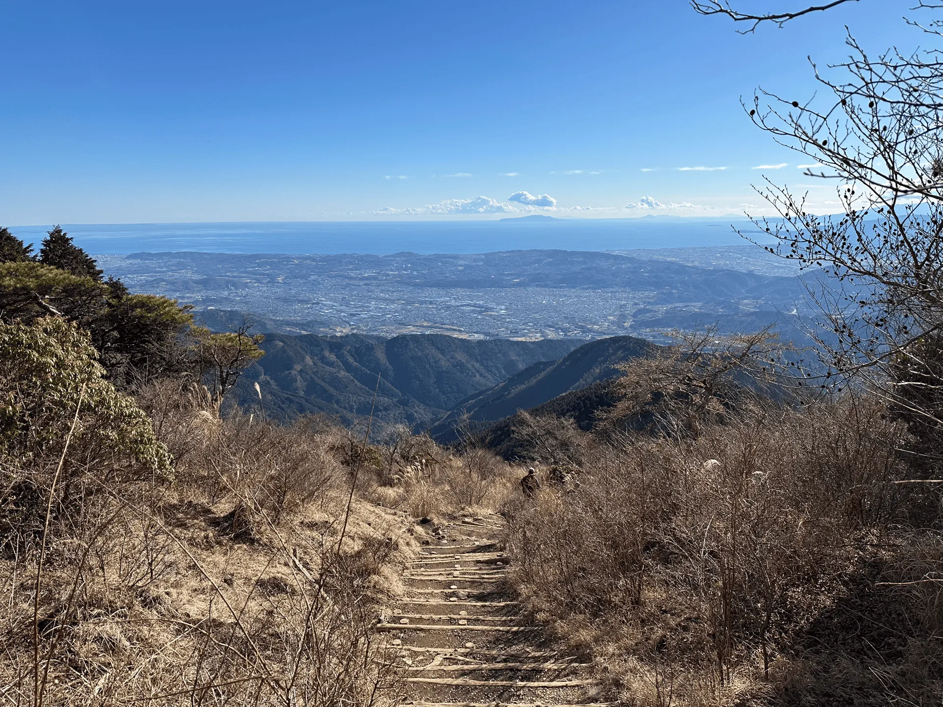
Today we finished our hike by about 3:15pm, with plenty of daylight to spare. In winter, it gets dark by 5pm so I would be careful to finish your hike before then.

Before heading home, we stopped off at the train station’s Mister Donut store for some coffee and a well-earned donut (or three).
Hiking course options
There are two main trailheads to reach Mt Tonodake:
- From Okura (大倉), which I’ve covered previously in my Mt Tanzawa blog. This one has quicker bus access, but with the downside of a long, long climb of mostly stairs.
- From Yabitsu-toge (ヤビツ峠), which comes with a more varied climb, passing other minor peaks on the way.
In terms of effort, they’re about the same. Yabitsu-toge adds an extra kilometre to the course, but has slightly less elevation gain overall. Whichever one you choose, you’ll be coming back down via Okura, since this has the better bus access to get back to the train station.
If you’re not too sure about your hiking stamina, taking the out-and-back from Okura is the better option because you can bail at any point along the way. With Yabitsu-toge, you’ll probably want to commit to climbing the full thing, since the buses back are less frequent.
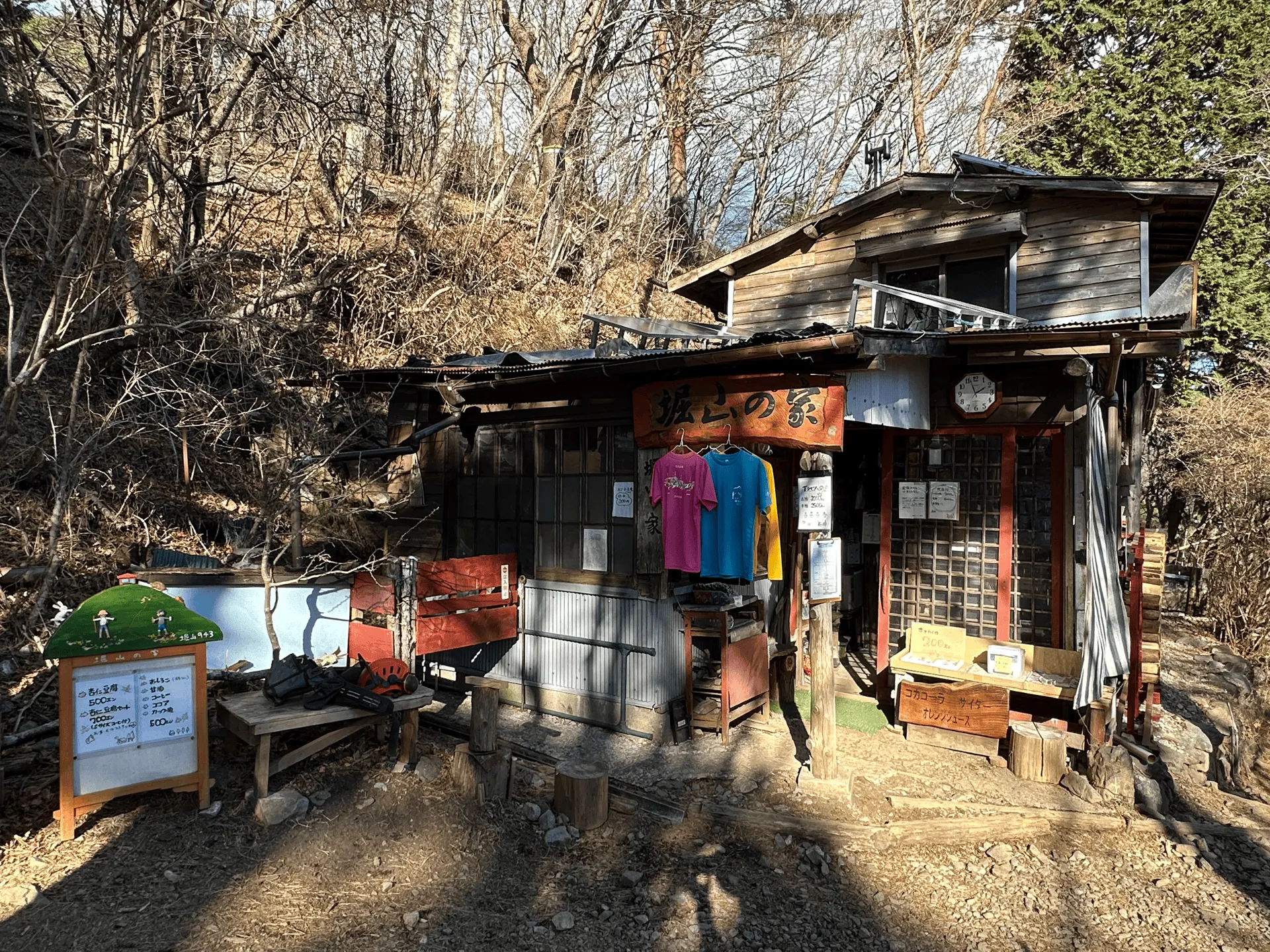
There are toilets and mountain huts at a number of points along the trail.
Public transport access with itinerary
If you are hiking via the Yabitsu-toge trailhead, there are buses running from Hadano station. The lines for the bus when we hiked at the beginning of January were immensely long, but they put on about 3 extra buses to try and clear up the crowd, so I think at worst, you’ll have to wait for the second scheduled bus.
If you are looking for details on how to get to the Okura trailhead, I mention it on my Mt Tanzawa post.
| Time | Location | Transport | ||
|---|---|---|---|---|
| 06:00 | Shinjuku station (新宿駅) | Train (Odakyu line) | ||
| 07:08 | Hadano station (秦野駅) | |||
| 07:20 | Hadano station | Bus | ||
| 08:08 | Yabitsu-toge bus stop |
For the return trip, there are 3 - 4 buses per hour running back from Okura, so you can be fairly flexible with the return times.
| Time | Location | Transport | ||
|---|---|---|---|---|
| 16:38 | Okura bus stop (大倉) | Bus | ||
| 16:53 | Shibusawa station (渋沢駅) | |||
| 17:13 | Shibusawa station (渋沢駅) | Train | ||
| 18:44 | Tokyo station (東京駅) |
For the buses, you’ll get on from the rear exit, and get off at the front. They let you use IC cards like Suica, so remember to tap on when you get on the bus.
Otherwise, take a paper ticket from the machine and hand this together with cash to the driver when you get off (the ticket let’s the driver know where you got on to calculate the fare).
Car access
There is a car park at Yabitsu-toge’s trailhead, but for how popular this trailhead is, it is way too small, and can probably only fit 20 cars.
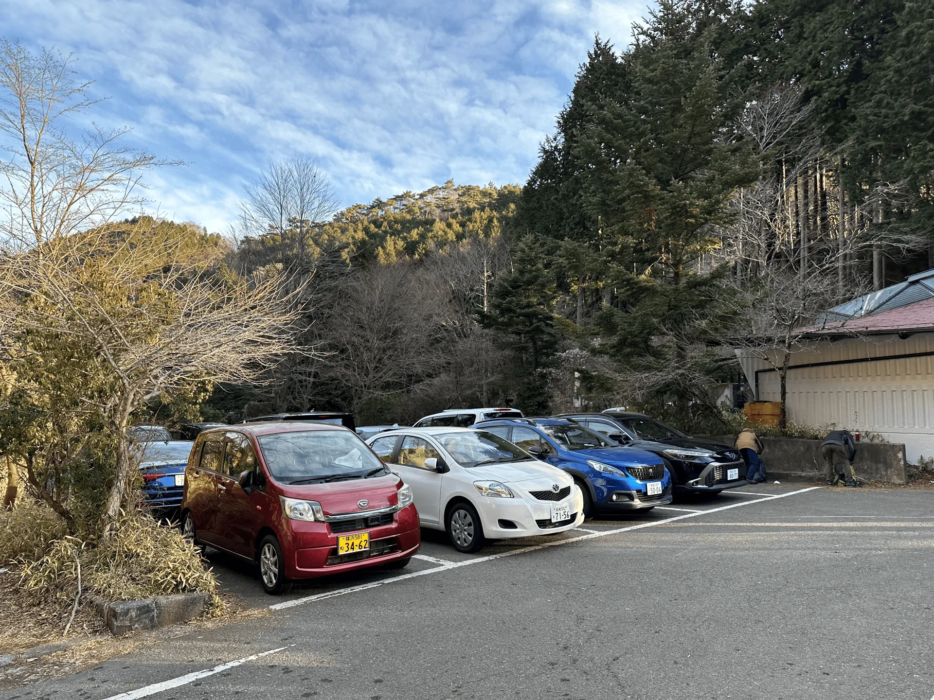
The drive up to this trailhead is along a long, windy road, so I wouldn’t want to drive up here, and then have to turn around to drive 20 minutes back down the road if it was full!
I definitely would recommend coming by bus for this one.
When to hike Mt Tonodake
The Tanzawa mountain range is notorious for its leeches (ヤマビル or “yama-biru”) in summer, so I wouldn’t recommend coming here during the summer months. Since it only has a maximum elevation of 1500m, it will be quite hot anyway, so I recommend finding higher elevation mountains to climb during summer if you can.
The best time to climb Mt Tonodake is as it starts to get colder, like in October or November. You can enjoy the autumn leaves, and the chances of Mt Fuji being visible increase in the colder months. There wasn’t any snow when we hiked in mid-January, but there definitely be snow in February and at least part of March, before it all starts to melt. Once it melts, you’ll have another opportunity to climb Mt Tanzawa in April - May, before the heat sets in!
I recommend checking YAMAP to see the conditions before you climb.
Comments
Leave a comment